Day 4: Gooch Gap to Woody Gap

Date:      Tuesday – 22 April 2014
Start:
      Gooch Gap Shelter                      15.8 miles                    Today:            5.2 miles Finish:   Woody Gap                                  21.0 miles                    Total AT:     21.0 miles

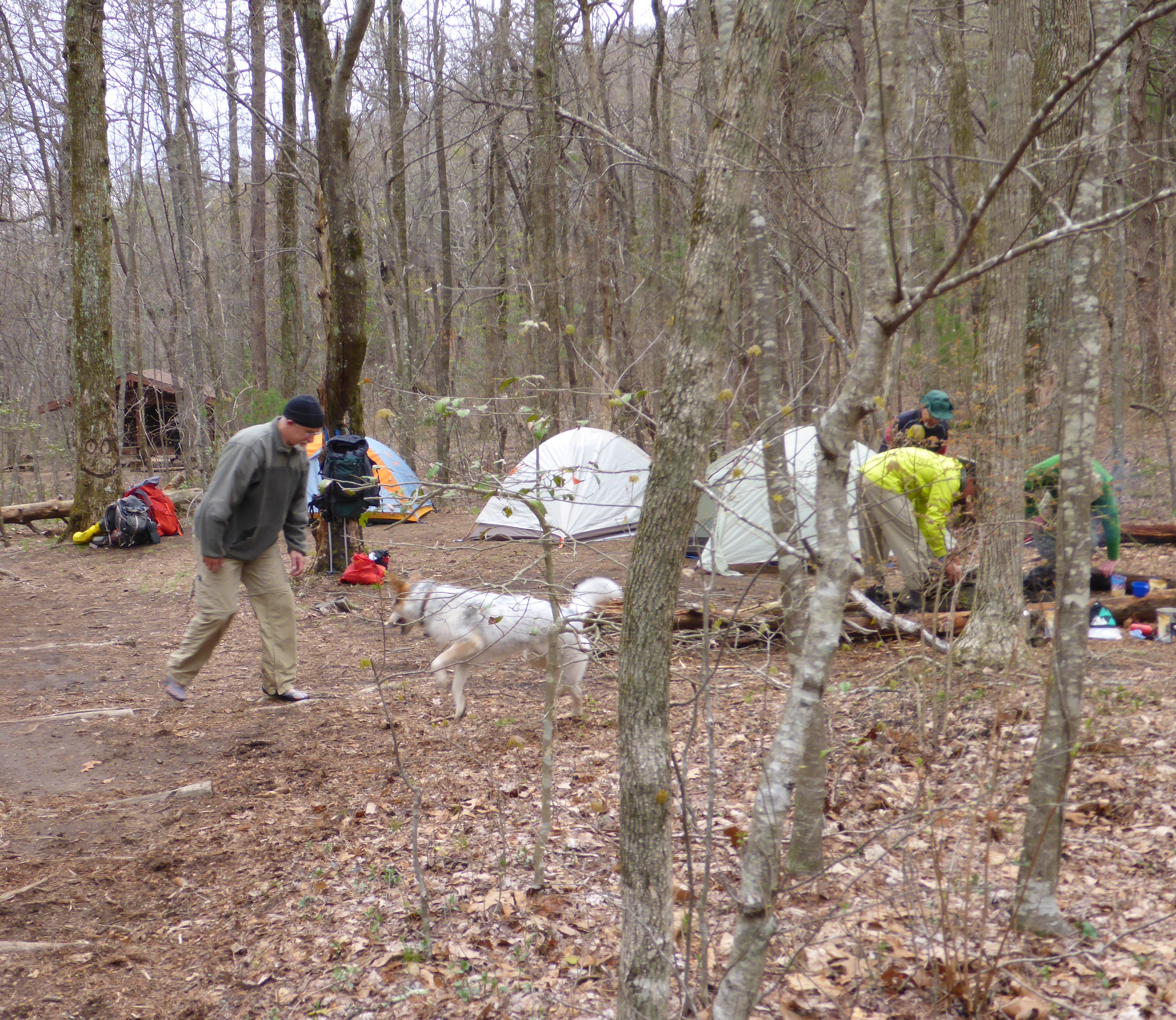
Deciding to only hike 5.2 miles today was the perfect excuse to sleep in. I didn’t even bother setting an alarm. By the time I woke up, just after 8:30am, Rob Steady was long gone.

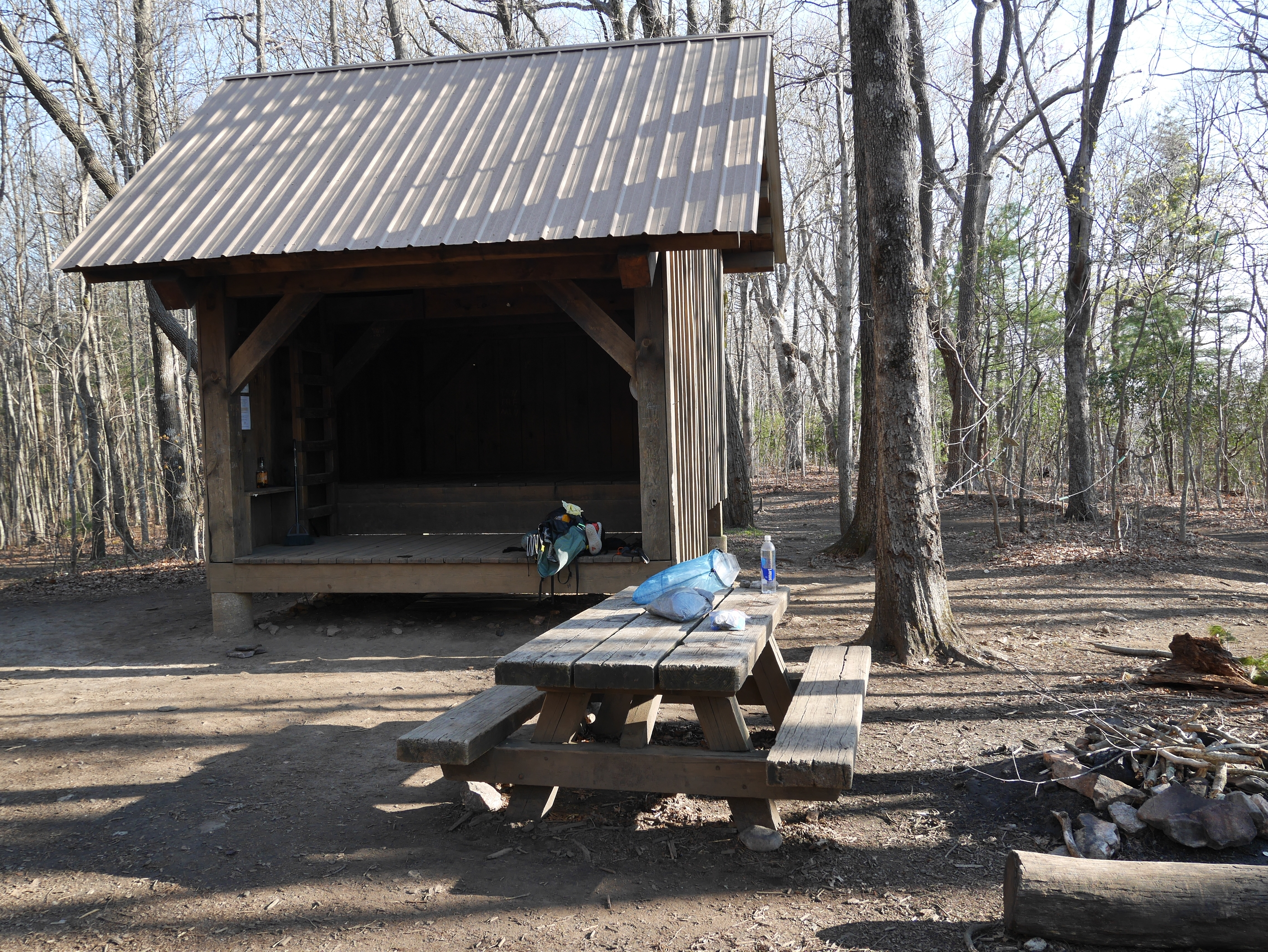
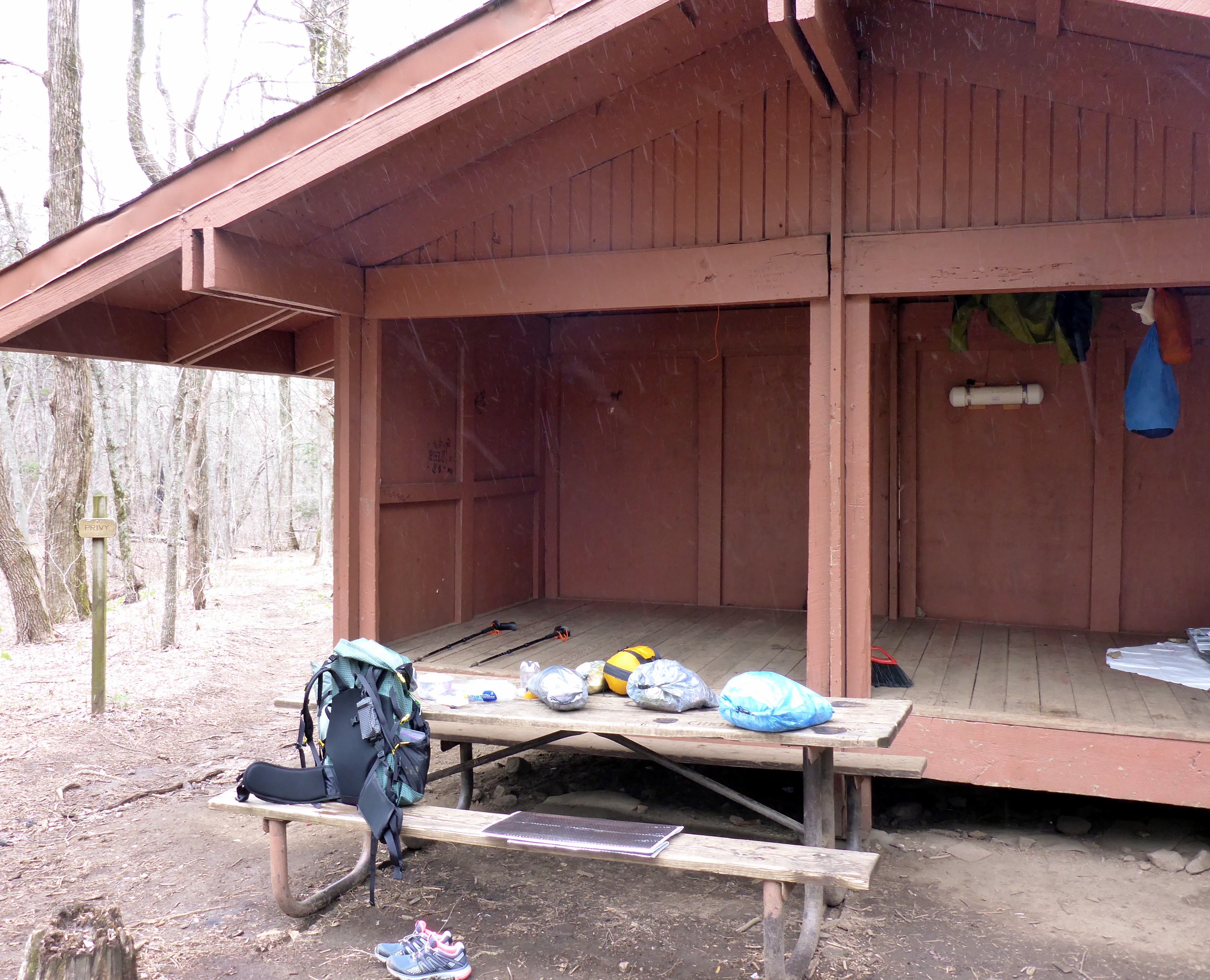
I packed up my tent, went up to the shelter to make breakfast, and was shocked to find it empty. I guess Bear Grylls took Danny’s advice and got an early start after all. I was genuinely not expecting that.

Catherine joined me at one point, and I almost made a comment to her about Mr. Grylls’ likelihood of finishing a thru-hike (low) and how shocked I was that he’d left before 9am (very), but thought better of it. It’s too early in the day for negativity, and I’m certainly in no position to throw stones.

That turned out to be an exceptionally good decision as Bear was most emphatically not gone. He’d just decided to sleep upstairs, where he was completely hidden from view. I was sitting at the picnic table eating a Lara Bar and trying to decide if I wanted to heat some water for oatmeal when suddenly his head popped up over the edge of the shelter and scared me badly enough that I shouted and dropped my breakfast.

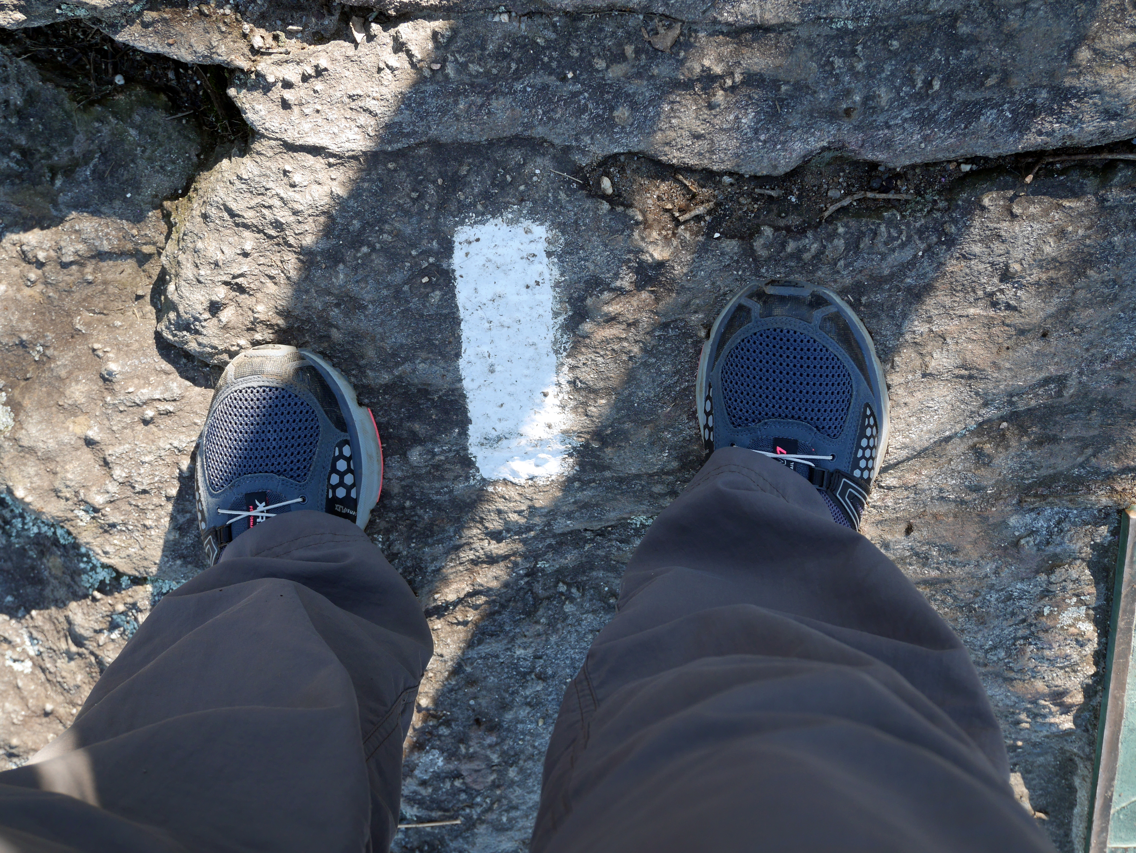
At 9:50am I shouldered my pack and set off.

At 9:51am I felt raindrops and returned to the picnic table, where I put on my raincoat and my rain pants, double-checked my dry bags, and wrestled my pack cover on before bravely heading back out into the coming storm.

At 9:59am the rain stopped, and I had to strip everything back off before I died from heat exhaustion.

I don’t know what I was thinking. I grew up in the Pacific Northwest. I have hiked in the rain before. A light drizzle does not warrant a full rain suit. That way lies only sweat-soaked clothes and misery.

P1000358

I did keep the pack cover on just in case, which of course guaranteed no rain for the rest of the day.

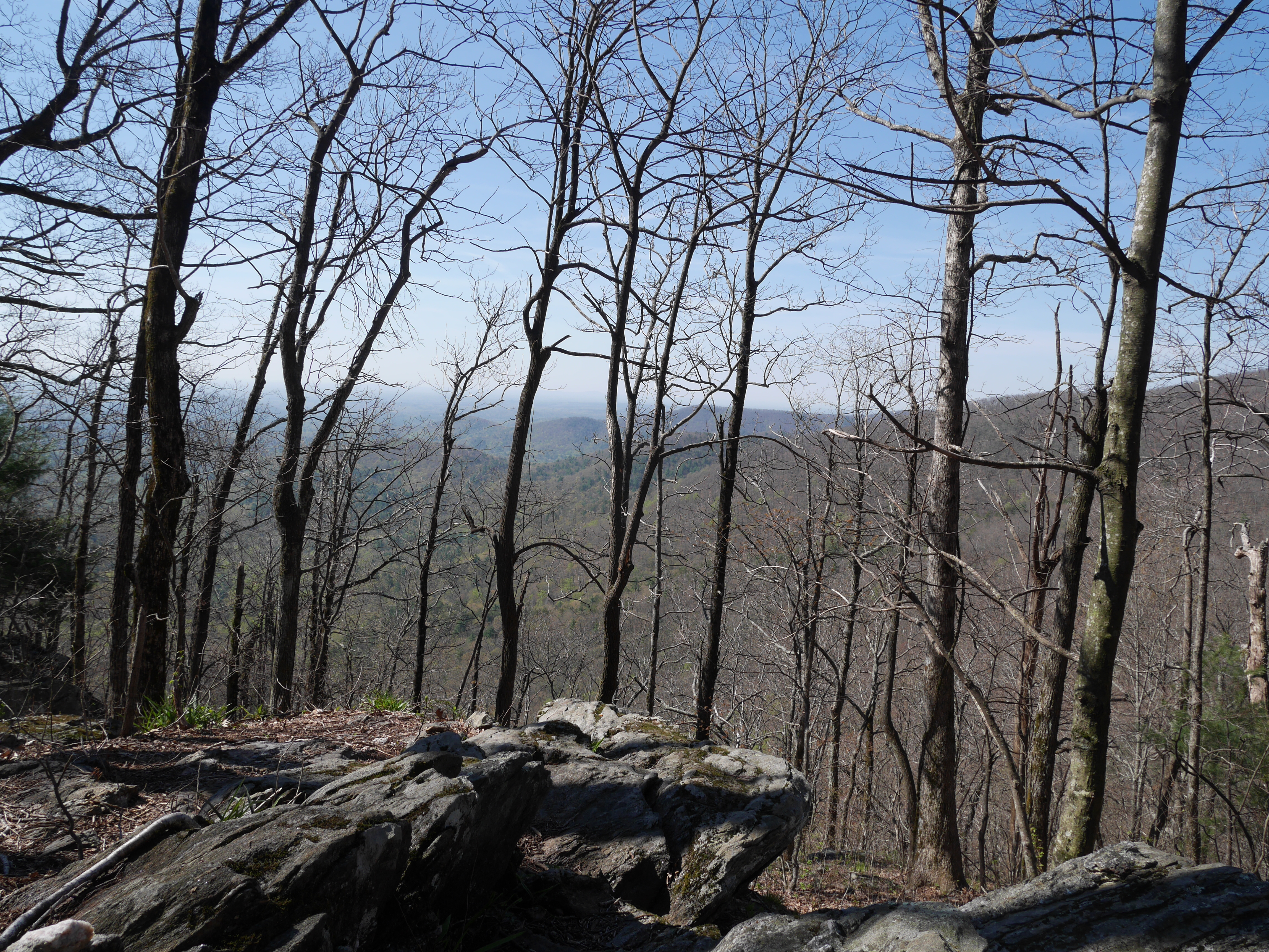
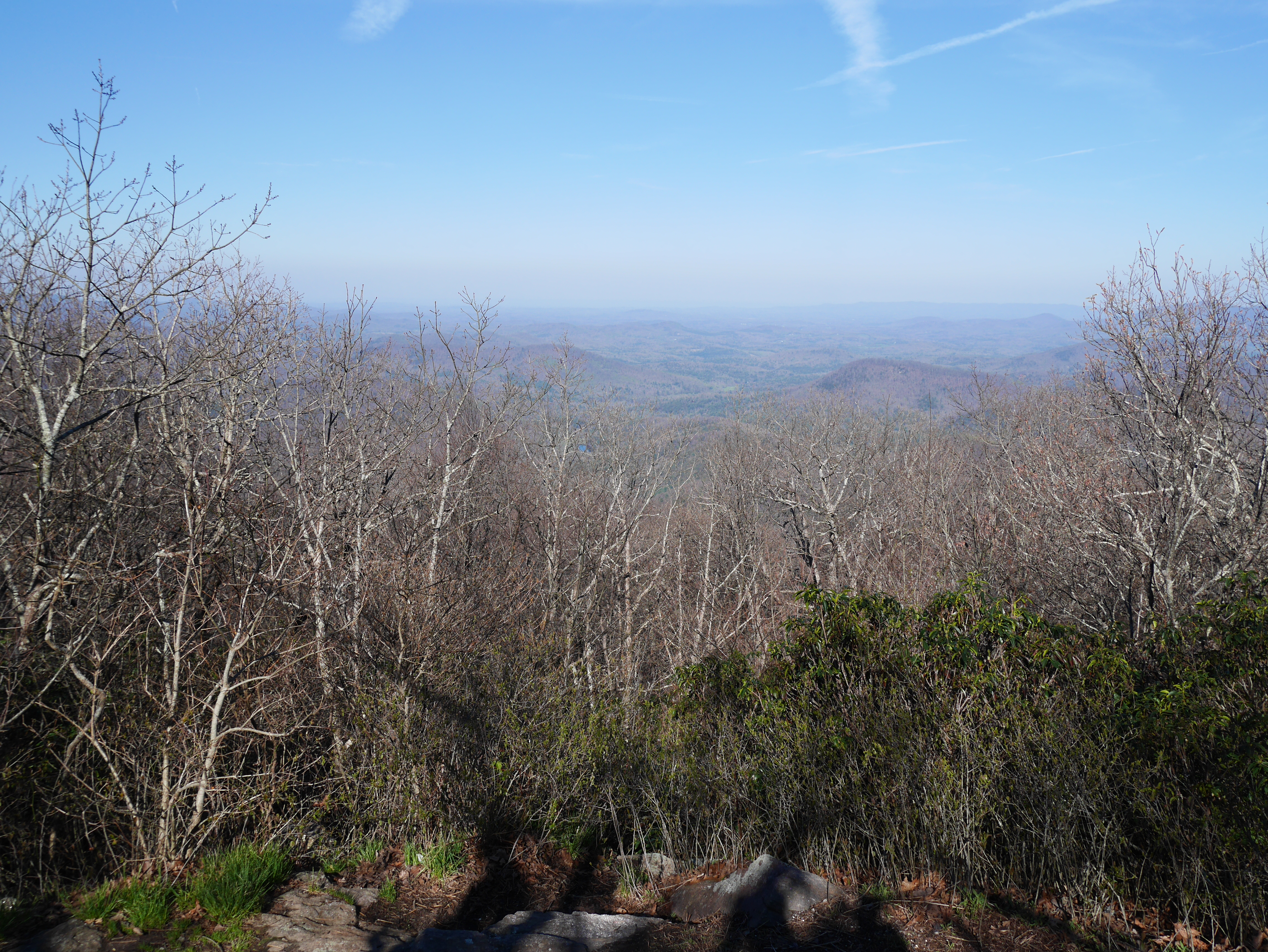
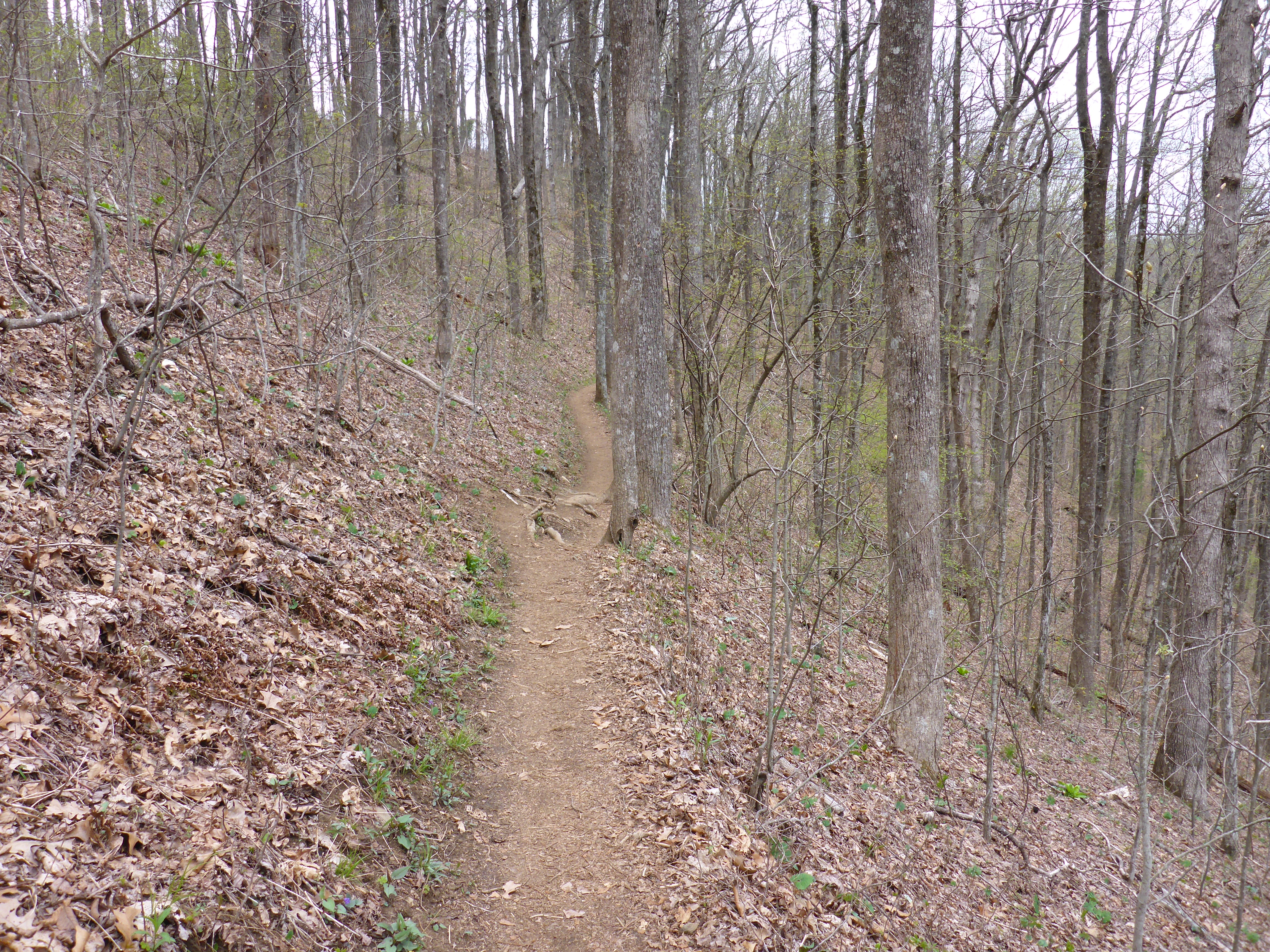
The clouds stuck around, though.

P1000341  P1000353

I took a Twix break at Gooch Gap, where USFS 42 crosses the trail. While I was sitting on a log, a guy drove up in a pickup truck and came over to say hi. He introduced himself as Papa Smurf which, as trail names go, is reasonably accurate if you overlook the missing hat.

P1000376           papa_smurf_by_kintaki92-d3j0tic

Papa Smurf told me he was heading up to Gooch Mountain Shelter to leave a note for a young woman he’d rescued after she sprained her ankle badly on the first day of her thru-hike. He and his wife took her in for two weeks while she recovered, and they’d just put her back on the trail yesterday.

Now that? Is some serious trail magic.

He offered to give me a ride to the Hiker Hostel from Woody Gap if I could get there by 2pm, so I crammed the rest of my chocolate bar into my mouth and tried to shuffle a little faster. Joan and Catherine blew past me maybe fifteen minutes later. Papa Smurf had made them a similar offer, and they were not going to miss out on that ride.

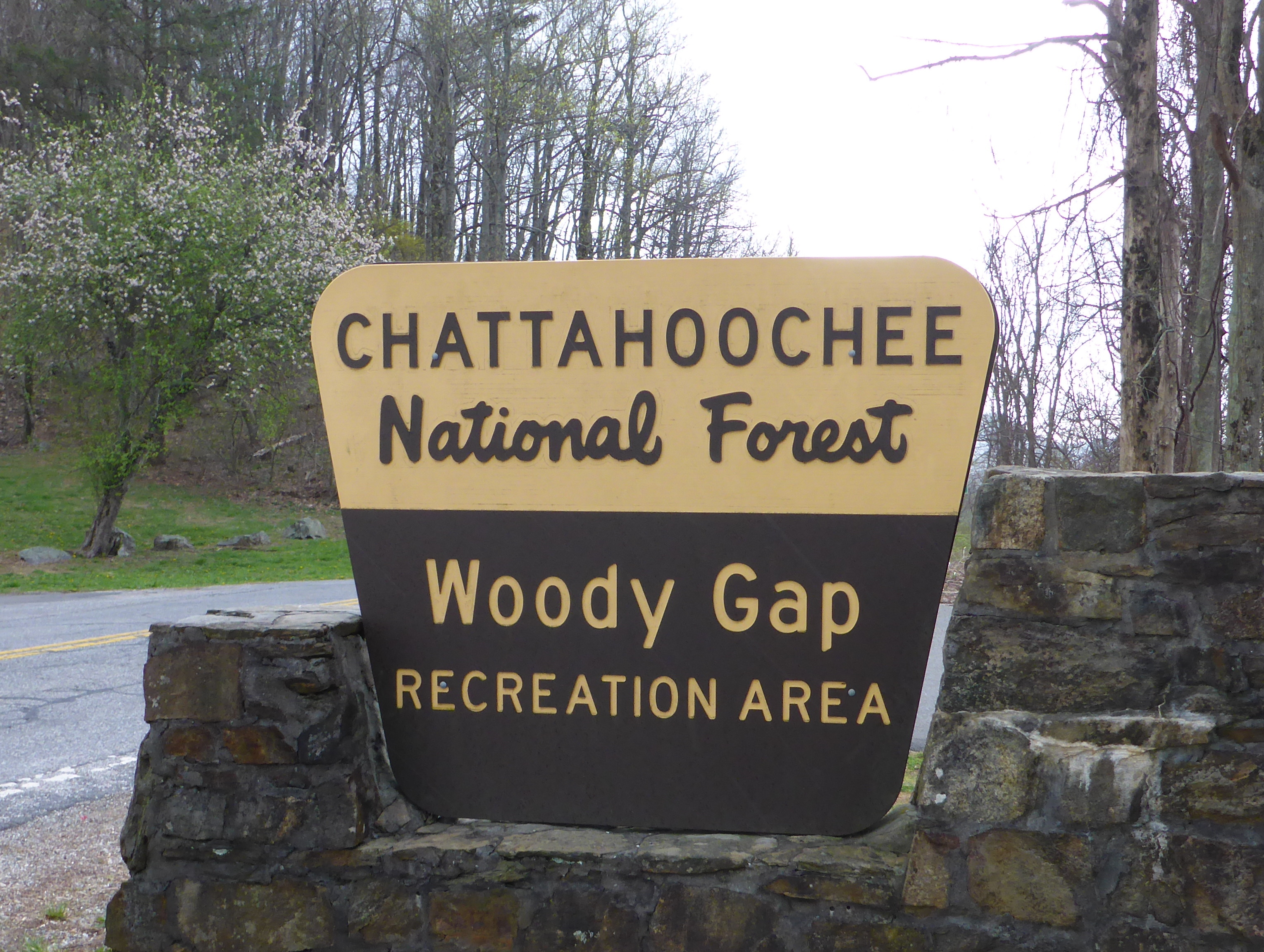
I trudged and checked my watch and trudged and checked my watch and trudged and checked my watch and, despite my best effort, didn’t roll into Woody Gap until 2:30pm.

Noooooooooooooooooooooooo!!!!

Such is the fate of the slow hiker. I had just psyched myself up for either hitching a ride or hanging around until 5pm for the Hiker Hostel shuttle when I spotted Joan and Catherine sitting under the cover of the Woody Gap sign near the restroom. Ha! Not too late after all.

While we were waiting, six cars pulled into the parking area. I’m not the most observant person in the world, so I just registered a bunch of grey vehicles, but Joan poked me and pointed out they were all identical brand new Porsches.

Huh. That’s… probably not a coincidence.

Some of the drivers had gotten out and were milling around, so I casually wandered over and waited for someone to make eye contact so I could start asking questions. It turns out they were all test driving an as-yet-unreleased model and, sadly, were legally prohibited from offering rides to hopeful hikers.

Papa Smurf showed up before I had a chance to ask how I could get in on this sweet test-driving gig, but I did get one gentleman’s business card and blog address so hope is not yet lost. I’m certain I would make a fantastic test driver. My driving record is spotless, and nobody ever needs to know that’s only because I’ve spent fewer than 200 days behind the wheel in the last decade.

P1000374   P1000375

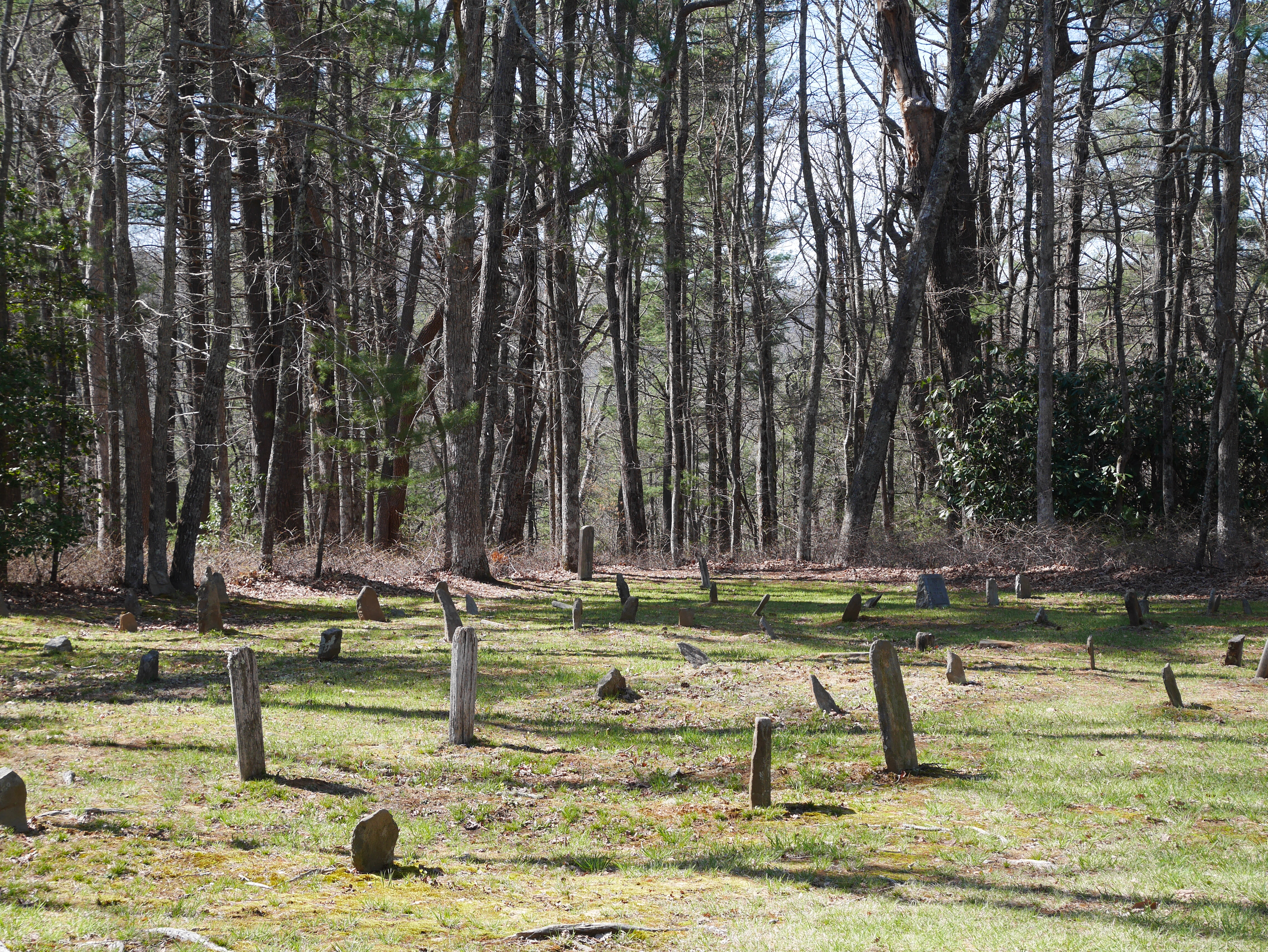
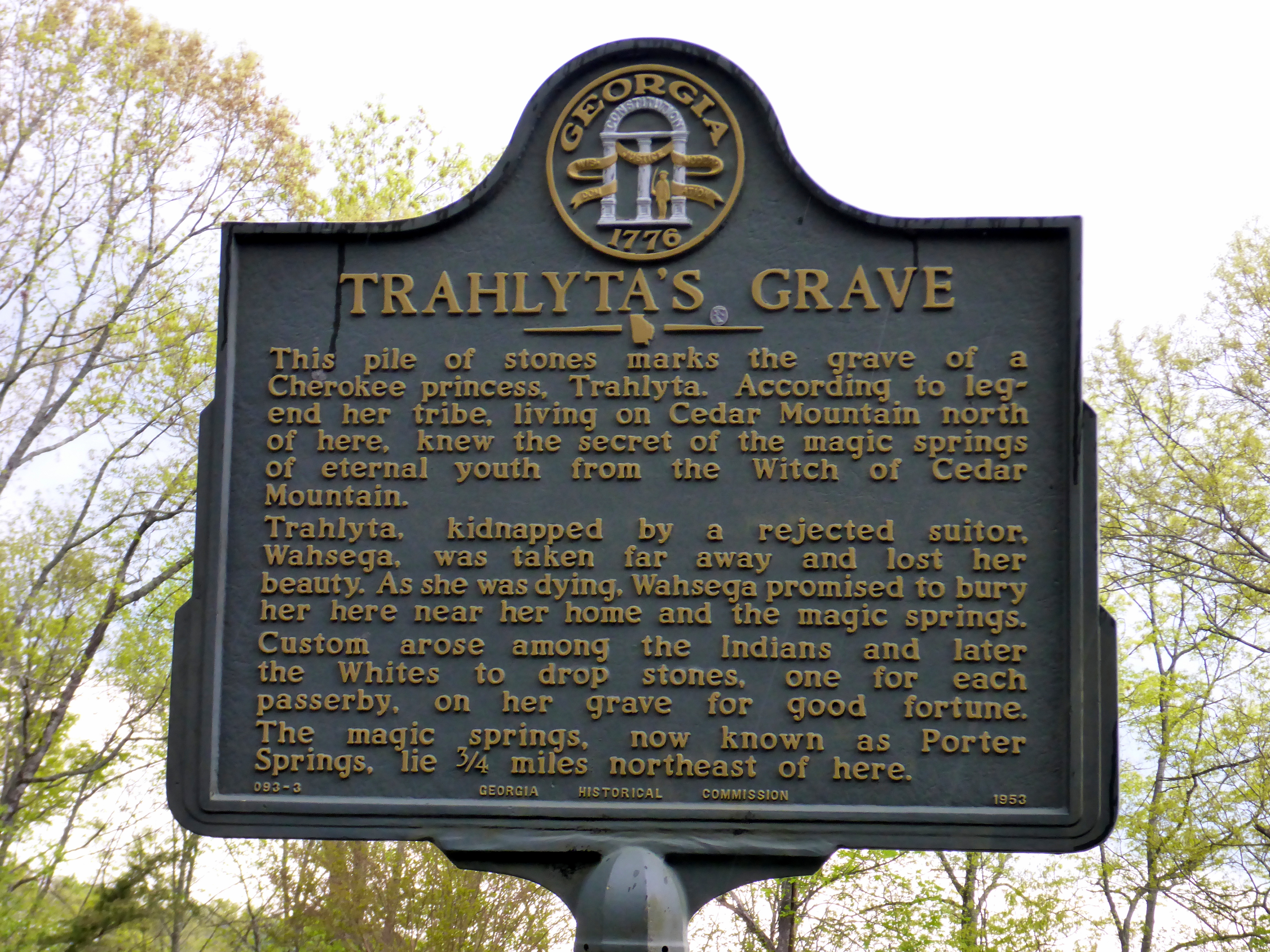
On the way the Hiker Hostel, Papa Smurf stopped a few times for photo ops. This grave is right in the middle of an intersection.

P1000377   P1000378

Joan, Catherine and I got lucky at the hostel and managed to snag their last three open bunks. They took the private queen room upstairs, while I ended up on a futon in the basement. It was so nice to be done hiking by mid-afternoon. We made arrangements to slack pack the next day, pooled our clothes to do laundry, and ordered vegetarian pizza for dinner. While waiting for that to arrive, I raided the hiker box for extra snacks and came away with six Oreos, three packets of chicken ramen and a bag of BBQ corn nuts.

I also had an interesting chat with another hiker named Sam. He runs a towing company in Florida and came up to hike the length of Georgia, but halfway through his first day his knee gave out. I made the mistake of asking him about his most unusual or interesting towing stories. Maybe he’d had to pull a car out of a swamp and an alligator was inside? Or maybe he’d gotten a call from someone who’d driven into a Best Buy or something?

That led to a unbelievably racist monologue about how Haitians were the worst drivers, just the worst, white people would never drive that badly.

I stopped talking to Sam after that.

Fortunately there were plenty of other conversational targets on the premises. The hostel was hosting a three-day ultra marathon that would begin tomorrow, and several members of the Dahlonega Ultra Marathon Association were spending the night. There’s a 1km dirt trail on the property, and these people were going to run around it. Over and over again. All day and all night. For three days. For fun.

That’s simultaneously inspirational and horrifying.

Over the next three days, whenever the trail started to drag me down, I’d just think about how much easier hiking is compared to ultrarunning and suddenly nothing would hurt quite so much.

Posted in Appalachian Trail | Tagged , , , , | Leave a comment

Day 3: Hawk Mountain to Gooch Mountain

Date:       Monday – 21 April 2014
Start:
      Hawk Mountain Shelter                       8.1 miles                    Today:          7.7 miles
Finish:   Gooch Mountain Shelter                    15.8 miles                    Total AT:   15.8 miles

Today was a very  s  l  o  w  morning, even slower than yesterday. I set my alarm for 6am but didn’t actually manage to break camp until 9:20am. This is becoming a disturbing trend, as it marks the second day in a row I’ve hit the trail exactly three hours and 20 minutes after my alarm went off. I’m concerned I’ll need to set it for 3:00am if I ever want to start hiking before 7am.

By the time I crawled out of my tent, Pop-C and the North Carolinians were long gone, never to be seen by me again. Joan and Catherine left ten minutes before I did, and I didn’t catch up with them until that evening.

All in all it was a pretty lonely day on the trail, and most of the people I passed were heading in the opposite direction. I met a family of five, a retiree doing trail maintenance and an older couple wearing very crisply-pressed matching khaki outfits hiking southbound. The only three northbounders I encountered were two 30-something guys from Alabama out on a ~90 mile section hike and a thru-hiker named Rob Steady.

Mr. Steady was also using a ULA Catalyst, which thrilled me to no end because he’s already got his Triple Crown, and this will be his third AT thru hike. Clearly I, too, will succeed in all my hiking endeavors because we have chosen the same type of backpack.

(False equivalence? What are you talking about? Look, a cougar!)

The elevation map for this part of trail didn’t look that bad, but I found the ups and downs pretty grueling, particularly the section between Horse Gap and Justus Creek that crossed Sassafras Mountain (3342 ft) and Justus Mountain (3226 ft). I thought I took this picture from the top of Sassafras, but it turned out to be a particularly demoralizing false peak.

P1180856

The weather was cool enough that I kept my fleece on for most of the day despite all the climbing. That was probably a good thing, considering I fell down two more times. I’ve got another scrape on my left knee and a bruised right elbow, but I’m pretty sure the damage would be worse if I’d been in short sleeves. My forehead smacked right into the dirt on my second fall; I’m only grateful no one was around to witness this firsthand.

Fortunately, my spirit remained unbroken!

P1180858

One of the more frustrating things about being a novice hiker is how much I don’t yet understand about personal hydration and water management. I don’t know how my pace varies based on terrain, so I’m never quite sure how long it will take to reach the next water source. I also don’t have any idea how much water I  drink per hour on average or how that will change based on the weather conditions. I’m always either carrying too much water or too little, and I’m not even close to dialing it in.

Today was a “carry too little” day, and I didn’t realize there was an 8.3-mile section of trail without any water sources whatsoever.

Oops.

I ran out of water at Horse Gap, four miles short of the next stream, and was seriously considering sticking a pebble in my mouth to generate some saliva when I stumbled upon this cache at Cooper Gap.

P1180885

My first bit of trail magic! I was later told that local shuttle drivers do a water drop here every day during peak AT hiking season.

I sat down at the base of that tree and immediately chugged half a liter. I didn’t want to drink too much water out of consideration for other potentially thirsty hikers on the trail, but I figured taking half a gallon would be fine.

While I was sitting there, an extremely chatty section hiker came through heading south. This guy just would not stop talking.

His name is Danny and he’s from Florida and he’s in the Special Forces and he brought two knives with him, two big knives, one of them weighs a whole pound, and he could show them to me if I wanted to see them, but it was actually a mistake to bring them because he hasn’t used them at all and he’s only out for eight days but he’s ahead of schedule and he’s on his way back to his car now and he’s really loved the trail and is probably going to come back and do some more but not with his wife because she doesn’t like camping so he’ll bring his sister-in-law instead because she does like the outdoors and they do all sorts of canoeing and hiking and climbing together and he probably should have married her but she was too young so he married her sister instead and before he starts driving home tomorrow he’s going to come back to Cooper Gap to pick up a thru-hiker going by the trail name ‘Bear Grylls’ who is young and injured and has been making all sorts of foolish decisions and if I’m going to Gooch Mountain Shelter could I please give him a message because Bear is taking a zero at Gooch Mountain and needs to understand that the hike from there back to Cooper Gap is pretty hard so he should get an early start and am I sure I don’t want to see one of the knives?

I did a lot of nodding and smiling, drinking my free water and letting his words wash over me like gentle ocean waves.

When I finally reached Gooch Mountain Shelter, the first people I saw were Joan and Catherine.

P1180891

Then I spotted Mr. Grylls sitting in the shelter. Oh, where to begin, where to begin. Before I left for the trail, I read a lot of stories about underprepared hikers carrying inappropriate gear, but honestly? I thought a lot of it was exaggerated for comic effect.

I no longer think that.

Mr. Grylls, who will be turning 21 in September, weighs 310 lbs and started the trail in eleven-pound carpenter jeans and steel-toed work boots, although he was forced to cut out the steel toes on his third day after the blisters got too bad. He brought only power bars to eat, and he ran out of those on the second day. He had a tent, but it was too heavy so he dumped it in the back of a day-hiker’s pick-up truck at one of the road crossings. Now he stays in the shelters in his too-thin sleeping bag, which he bought from Wal-Mart and is probably only rated to 50 degrees. He’s got a machete, a $300 solar charger and he’s keeping a video diary, but he’s only got four dollars in his wallet to get himself to Maine.

P1180890   P1180896

I actually really liked him. He’s quite charming and speaks very candidly about his lack of experience, and I could legitimately see him staying on the trail for a few months while relying on the kindness and generosity of strangers. I mean, let’s be real, there’s zero chance he’ll manage a thru-hike, but he could definitely live in the woods for awhile before heading back to his real life.

(Note: I had to ask the internet how to spell ‘Bear Grylls’ and, in doing so, discovered he has named his three sons Huckleberry Edward Jocelyne, Marmaduke Mickey Percy, and Jesse. Why does poor Jesse have such a short, pedestrian name?? I feel so sad for him.)

Rob Steady was also camping here, so the five of us ate dinner together and chatted. Bear Grylls told us about his time on the oil rigs, I interrogated Rob about all his fancy cuben fiber gear, and Joan told us she and Catherine had decided to get off the trail at Woody Gap tomorrow and make arrangements with the Hiker Hostel to slack pack the rest of Georgia.

I latched onto this idea immediately. I didn’t want to slack pack all the way to North Carolina, but I was sore from hiking and sore from falling, and I wasn’t sure if I wanted to tackle Blood Mountain with a full pack.

It’s 15.9 miles between Gooch Mountain Shelter and Neel Gap, the next convenient resupply point. Between 1 March and 1 June, the two shelters in that section of trail – Woods Hole Shelter and Blood Mountain Shelter – are closed to overnight campers unless you’ve got a hard-shell bear canister. The ominously-named Blood Mountain is 4461 feet high, and I’d heard rumors it was a difficult climb and an even more difficult descent. There are designated campsites at Lance Creek, about halfway between Gooch Mountain and Neel Gap, but I wasn’t sure if they had bear cables, and there were few enough people on the trail that I worried I might be the only person sleeping there.

More to the point, this was going to be my third night sleeping outside. I really missed hot water and flush toilets. This new plan meant I’d only have to hike 5.2 miles to Woody Gap tomorrow, could spend a glorious night on a mattress indoors, and then just carry a day pack over Blood Mountain. Thank you, Joan! You have the best ideas.

Posted in Appalachian Trail | Tagged , , , , | Leave a comment

Day 2: Black Gap to Hawk Mountain

Date:      Easter Sunday – 20 April 2014
Start:
      Black Gap Shelter                             -1.5 miles                      Today:        9.6 miles
Finish:   Hawk Mountain Shelter                   8.1 miles                      Total AT:   8.1 miles

A lot of hikers swear by the shelters. They love ’em. They’re so convenient, there’s so much camaraderie, blah blah blah. I hated my first night in Black Gap Shelter, hated ever single minute of it.

  • I am a light sleeper and Pop-C snored.
  • I am a cold sleeper and a structure with only three sides doesn’t retain heat very well.
  • I am a restless sleeper and felt guilty every time I rolled over because my mattress made the most godawful rustling noises.
  • I am a private sleeper and do not enjoy knowing someone could be watching me drool.
  • I am a lazy sleeper and would prefer to pee in a bottle at 3am than leave the warmth of my sleeping bag to venture outside in search of a more secluded location.

Also? It turns out I’m a late sleeper. My alarm went off at 5am as planned, and it took me almost one full minute to turn it off because my right hand was numb from the cold and my left hand was numb from sleeping on it. I kept dragging my unresponsive fingers across the screen, desperately trying to muffle the sound with the corner of my sleeping bag while praying nobody tenting near the shelter could hear it.

Pop-C jumped up right away, packed his stuff and hit the trail before 6am as planned. I just continued to lie there, waiting for him to leave so I could go back to sleep. So much for my grand aspirations of the previous evening.

I didn’t break camp until 8:20am, long after sunrise had come and gone.

P1180803

At least the weather was gorgeous, and it only took about an hour before I reached the summit of Springer Mountain, official starting point of the Appalachian Trail.

It was very exciting! I took some photos of the plaques!

P1180815  P1180810

I took some photos of my very first white blaze!

P1180811

I took some photos of the view!

P1180812

I took a bunch of slightly blurry off-kilter selfies, none of which I’m going to post!

It was great. I got a little too into the picture-taking, though, and completely forgot to sign the register.

Five minutes after I left the summit heading north, I started running into hikers who had been dropped off that morning at the parking lot. Not gonna lie, I felt really smug about having done the approach trail and tried to think of a way to subtly let them all know I was an overachieving superstar already on the second day of her hike.

The best conversational gambit I could think of was to ask what the parking lot was like, which is kind of sad and the polar opposite of smooth, so I just nodded regally at everyone I passed.

This included my second Sarah, hereafter known as “Sarah with a black dog,” and my first ridgerunner, Becky.

P1180818

Once I reached the parking lot, I loitered around in case someone wanted to give me something (food? soda? Easter candy? religious tract? anything?), but nobody was feeling very generous. Where is my weekend/holiday trail magic?! I’ve been on the AT for one whole mile, where is my reward?!

Trying to look needy got boring after ten minutes, so I got back on the trail and hiked another 1.8 miles to Stover Creek Shelter before stopping for a lunch of smoked salmon and seaweed. While I was there, I met Joan and Catherine, a thru-hiking mother/daughter duo from Toronto, and Roger from Houston, who’s carrying a 55 lb backpack with approximately ten days of food.

Let me just repeat that:  Ten. Days. Of. Food. Weighing 25 pounds. On his back.

Unsurprisingly, Roger was stopping at Stover Creek Shelter for the night, even though it wasn’t quite 1pm. I was a little jealous; the shelter was built in 2006 and looked lovely.

P1180832

Roger, who also hiked the approach trail, spent last night in his hammock at the Springer Mountain Shelter. I felt really good about my life and my choices after he told me everyone who opted to sleep in the shelter fled in the middle of the night because of “rats.”  Laziness pays off!! Clearly, stopping at Black Gap Shelter was the right decision after all.

Lesson learned:  Quit early or your face might get gnawed off at 2:30am.

Within ten minutes of leaving Stover Creek Shelter, I met my third Sarah. I wish I could say I was surprised, but I gave up the dream of being the only Sarah in any given social situation when Sarah Moen and I were assigned to the same second grade classroom and I had to start writing “Sarah B.” on all my assignments. It’s been downhill ever since.

Sarah #3 and I became acquainted when I heard her come up behind me and mutter, “What the hell is that? Ohhh…” Apparently she’d mistaken the camp shoes attached to the back of my pack for some sort of doll – a bright red, hairless doll. Sure, why not.

After we introduced ourselves, I made the rookie mistake of trying to walk and talk at the same time. Some people can manage that, but I am uncoordinated, graceless and clumsy under the best of circumstances, and the “best of circumstances” does not involve carrying 30+ lbs on my back. We exchanged, at most, three sentences before I fell down.

Awesome. There is nothing I enjoy more than falling down in front of a total stranger. On a perfectly flat section of trail, no less!  !@$!@%!@#$

P1000365

Ah well. Like death and taxes and the premature cancellation of whatever new television drama I’ve just started to enjoy, falling down on a semi-regular basis is one of the inevitabilities of the universe I’ve had to accept.

So is getting lost.

At Three Forks, so named because it marks the convergence of three different trout streams, the Appalachian Trail passes over a footbridge, crosses USFS 58 and continues uphill. It also happens to briefly merge with the Benton MacKaye Trail for about a mile before the BMT splits off to the west toward Long Creek Falls. The BMT is marked by a white diamond; the AT is marked by a vertical white rectangle. Imagine my confusion when I crossed USFS 58 and started walking up what I thought was the AT, only to be confronted with a diamond painted on a tree.

The 2014 AWOL Northbound guide doesn’t explicitly mention that the trails merge, probably because it assumes its readers are thinking creatures who don’t need to be spoon-fed information. Frankly, it’s giving me too much credit. I definitely require spoon-feeding. I can’t tell my left from my right without holding up my thumb and forefinger to make an “L”.

So when I crossed the footbridge and walked across the road and started climbing the hill and saw a white diamond painted on a tree, I thought, “Oops, must be on the wrong trail.” I turned around and went back across the footbridge. I walked up and down the bank. I crossed back to the other side. I walked up and down the road. I asked two women walking their tiny rescue dogs if they knew where the AT went. I asked a family having a picnic by one of the streams if they knew where the AT went. I got out my book again to see if I was missing something that would tell me where the AT went. I walked up the road again. I shook my fist at the sky.

WHERE IS THE TRAIL OH MY GOD I JUST WANT TO FIND THE TRAIL WHY IS LIFE SO TERRIBLE RIGHT NOW?!

Eventually Jerry and his buddies, the four section hikers from North Carolina I met the previous day, found me wandering in circles and were kind enough to pull out their map to reassure me that, diamonds notwithstanding, the trail I originally started hiking was indeed the AT. Sure enough, just past that stupid painted diamond was a tree with an AT blaze. I swore and kicked at a tree root until I felt better, but seriously, would it kill somebody to put a giant blinking neon sign at the base of the trail so hikers with a terrible sense of direction don’t have to suffer such needless confusion?? Maybe I could get a Kickstarter funded to pay for that.

Since I’d wasted half an hour stumbling around like a fool, I opted not to take the side trail up to Long Creek Falls, a decision I almost immediately regretted. I don’t know if I’ll ever be in this section of north Georgia again, and I don’t want to miss out on interesting sights and experiences simply because they’re not directly on the trail. That seems unnecessarily limiting.

I tried to make up for this oversight by taking a quick detour to Hickory Flats cemetery a little further up the trail.

P1180840

The place was completely deserted, and the sun felt really nice, so I took off my pack and had a little nap. I was tempted to turn it into a long nap, but I was low on water and the next source was two miles away at Hawk Mountain Shelter.

P1180849 P1180850

I made it to the shelter by 6:25pm to find Pop-C had rolled in four and a half hours ago. He’d already washed and dried all his hiking clothes, set up his spot in the shelter and reorganized all his gear. His efficiency is starting to give me a complex.

I opted to forego the shelter and set up my tent before joining Pop-C and the four NC section hikers at the picnic table for dinner. The mother/daughter duo from Canada were hammocking across the clearing, but we only exchanged waves.

I was inside my tent by 7:45pm.

P1180844

Posted in Appalachian Trail | Tagged , , , , | 1 Comment

Day 1: Approach Trail – Part #3

Date:      Saturday 19 April 2014
Start:
      Amicalola Falls Visitor Center          -8.8 miles               Today:              7.3 miles
Finish:   Black Gap Shelter                                -1.5  miles               Total AT:          n/a

After that first steep mile and all those terrible stairs, the trail flattened out and got a little easier. I wouldn’t go so far as to say it got a LOT easier, as there was still another ~750 feet of elevation gain to deal with, but at least it was spread out over the next seven and a half miles.

P1000299

My original plan was to triumphantly summit Springer, watch the sunset, and spend the night at Springer Mountain Shelter.

That is not what happened. That’s not even *close* to what happened.

At 4:40pm, six hours and 50 minutes after I left the Amicalola Falls Visitor Center, I reached Black Gap Shelter. When I spotted it through the trees, any thought I had about pushing on for another 1.7 miles immediately disappeared. I was so exhausted, and my feet hurt so badly, that I sat down on the picnic table and didn’t move for over an hour.

Every five minutes I’d think, “Ok! Time to set up the tent! Let’s go!” and then immediately rationalize doing nothing for just a little bit longer.

P1000323    P1000324

Pop-C, one of my bunkmates from the Hiker Hostel, had already set up his bedroll inside the shelter by the time I arrived. By 6pm, when I still hadn’t moved from the picnic table, I gave up the idea of tenting and decided to join him. We ended up being the only two people inside the shelter that night. Two other groups of section hikers did join us, but they all opted to stay outside.

Pictured on the left is Jim from North Carolina with his dog, Nonny (short for Anonymous). He decided to go on a short four-day hiking trip from Amicalola to Neel Gap, but didn’t want to go alone, so he rounded up three companions:  his neighbor, a Private from the Civil War re-enactment troop he Captains, and his tai chi instructor. Isn’t that just the most delightfully random group of people??

P1000325        P1180814

The two women on the right were just out for a quick overnight trip to test their gear. They’re planning to hike the 78.5-mile Georgia section of the AT in September. I liked them a lot because they shared their homemade cocoa/chia energy bars with me and the one in black is also named Sarah.

Yeah. Surprise! I didn’t even manage to make it one full day on the trail before meeting another Sarah. We are legion.

Pop-C ended up being an invaluable resource for me that evening. He strung up a clothesline running the length of the shelter so we could hang up our gear, impressed upon me the importance of not leaving anything chewable within reach of mice, cut my extra 50ft of cord into more manageable sections and used his lighter to melt the ends, taught me a knot to use for stringing up heavier objects like my backpack, showed me how he uses a plastic compactor bag as a tablecloth, demonstrated how that tablecloth also doubles as an emergency poncho, shared his “sweep and police” method of packing up a campsite, and advised me to shorten one hiking pole at night and keep it close to hand in case I need it to fight off a raccoon. Solid advice!

He also went off on a ten minute rant about how the patent for Aqua Mira only claims it works against algae and odors and doesn’t actually do any useful purification. I’m not entirely sold on his anti-Aqua Mira stance yet, but it freaked me out enough that I’m going to stick with my Sawyer mini-filter until I can do some additional research.

After dinner, I tackled one of the things I was most concerned about doing correctly:  hanging my food bag. It was really easy. Like, unbelievably easy. I can’t believe I wasted so much time worrying about it. All the hard work has already been done! There’s a cable dangling there, and all you have to do is clip one end to your bag and clip the other end to the bracket on a tree. It could not be simpler. I finally understood why I could never find any decent descriptions of how to hang your food bag from a cable system. The instructions would literally be something like, “Hang your food bag from the cable system. Walk away. Seriously, that’s it. You’re done.”

P1000330

P1000332

Mind you, I was still worried about how I was going to manage hanging my food bag from a tree without assistance, but at least I could stop worrying about not being able to figure out the cable system.

By 8:45pm it was completely dark. I tried to use my headlamp to read my Kindle, but quickly tired of the insects dive-bombing my face. I now deeply regret not upgrading to a Paperwhite with a built-in light.

Pop-C wanted to get an early start, and I was absolutely committed to following him like a duckling in order to learn more camping tips, so I volunteered to set my iPhone alarm for 5am so we could get in some pre-dawn hiking and make it to Springer for the sunrise. It was lights out by 10pm.

Posted in Appalachian Trail | Tagged , , , , , | Leave a comment

Day 1: Approach Trail – Part #2

Date:      Saturday 19 April 2014
Start:      Amicalola Falls Visitor Center          -8.8 miles               Today:              7.3 miles
Finish:   Black Gap Shelter                                -1.5  miles               Total AT:          n/a

This is a helpful sign. Thanks sign, for pointing me in the right direction.

P1000269

This is an upsetting sign. I don’t want a fatal injury!

P1000271

And this… this is an obnoxious sign. I definitely don’t want to climb these stairs. Don’t tell me how many steps there are, it’s too demoralizing.

P1000274

It is possible to bypass the stairs by following the road that leads to the top of the falls, but that seems like a bit of a cop-out. These first 175 steps actually weren’t that bad. It’s the next set of 425 stairs I could have done without.

I haven’t even walked a mile yet, and I’m already sweating.

P1000278

As you climb, there are plenty of places to stop and rest, which I appreciated. I can see why people suggest taking the road during icy weather because those steps would definitely be slippery, but fortunately that wasn’t an issue today.

At the top of the falls there’s a beautiful view down into the valley.

P1000293

More importantly, there’s also another bathroom, which I took full advantage of because I am loathe to say goodbye to indoor plumbing and will stretch out this farewell process as long as possible.

Since it was the weekend, there were a fair number of tourists and local day hikers out; the only other self-identified thru-hiker I saw that day was Ali, one of the guys from the Hiker Hostel. Everyone else I chatted with was only planning to do a section hike.

I was actually a little surprised at how few people were on the trail overall. I didn’t keep an exact count, but I’d estimate that between the top of the falls and Black Gap Shelter I only saw fifteen people. I knew the main bubble of NOBO hikers was weeks ahead, but I still thought the trail would be more crowded. Not that I’m complaining, though. It’s safe to say nine out of ten hikers will pass me, so fewer people means fewer times I have to step off the trail to let them by.

Posted in Appalachian Trail | Tagged , , , , , , | Leave a comment

Day 1: Approach Trail – Part #1

Last night Ted warned me he was an early riser. He did not misrepresent himself. The lights went on in the room at 5am, which meant I had a lot of time to kill before breakfast. I think I spent forty-five minutes lying quietly on my back in my bunk trying to psych myself up for the first day of hiking.

P1180793

Breakfast was served buffet-style at 7am, and I broke my long-standing personal rule against mediocre food photography (the only type of food photography I know how to do!) to get a poorly-composed shot of my pancakes, eggs and oatmeal. I thought it would be nice to have something to gaze at each night after a deeply unsatisfying dinner of heat-and-eat trail food.

P1000234 P1000235

After breakfast, Derek asked for a show of hands as to who planned to do the approach trail and who just wanted to be dropped off near the official trailhead.

The approach trail, which starts at the base of Amicalola Falls, isn’t technically part of the Appalachian Trail, and whether or not one should do it as part of a thru-hike is another classic backpacking wank. It adds an additional 8.5 to 8.8 miles to the 2185.3 miles of official trail, depending on which source you want to believe, and starts off with a difficult climb up 600+ wooden stairs followed by approximately 7.25 miles of strenuous uphill hiking.

If you don’t want to tackle that on your first day, you can start from the Springer Mountain parking lot on USFS 42. It cuts out all that elevation gain you have to make if you start at the bottom of the falls, but instead requires some backtracking. The parking lot is 0.9 miles north of the start of the trail, so you’ve got to hike south for nearly a mile and then retrace your steps.

I opted to do the approach trail for three reasons:

  1. Amicalola Falls is the tallest cascading waterfall in the Southeast. It’s 729 feet tall! The chances I will ever find myself back in this area are vanishingly small, and I didn’t want to miss the opportunity to see it (mostly so I can endlessly brag about having seen it). I have a soft spot for superlatives and am easily manipulated by marketing campaigns. Best donut? Tallest building? Deepest freshwater lake? Longest blood sausage? YES PLEASE. TAKE ME THERE NOW.
  2. I don’t like to backtrack. I have very strong, very negative feelings about having to hike the same section of trail twice. I don’t care if it’s less than a mile, I’m not doing it twice and nobody can make me. I did some checking and found that a guy did get lowered down to the starting point by helicopter one year, but it only took two phone calls before I accepted that the helicopter option was going to be prohibitively expensive.
  3. The Amicalola Falls Visitor Center has a stamp. This year is the first year of the Appalachian Trail Passport program, wherein participating businesses along the trail can create a customized rubber stamp and hikers can spend six dollars to buy a small six-page booklet that will hold up to 48 stamps. This is directly based on the Pilgrim Passport used along the Camino de Santiago, and all the profits from passport sales is donated to the Appalachian Trail Conservancy. According to Hiking the Camino,


    The Pilgrim Passport, or “credencial,” is a document produced by an official pilgrim body, which is stamped at each of your overnight stays, as well as at churches, museums, restaurants and other attractions. The document serves both as a souvenir and as proof that you have done the route on foot. You must show your stamped credencial at the pilgrim office in Santiago in order to receive official recognition of your pilgrimage (a document called the Compostela available to those who have walked at least 100km or biked 200km to Santiago).

    You really only need to fill one passport to qualify for a Compostela. I, on the other hand, was a little over-enthusiastic and filled three. Pass a cafe, ask for a stamp. Pass a church, ask for a stamp. Go to a restaurant, ask for a stamp. I couldn’t make myself stop stamping. I’m not proud of it. I drank a lot of café con leche and Fanta Limon I didn’t really want just to be able to get another stamp because no one will ever convince me that stamping things isn’t objectively the most fun thing ever. There is no way I am going to miss out on getting an Amicalola Falls stamp.

I don’t know if Pop-C, Ali, Kathy and Bobby were as enamored with the possibility of a stamp as I was, but whatever their motivations, they also chose to be dropped off at the base of the approach trail. Since it was Saturday, we got to experience Close Encounters of the Bird Kind, where handlers displayed a cockatiel, a grey-faced screech owl, a red-faced screech owl, a great horned owl, and a red-tailed hawk.

P1000265  P1000246  P1000258

I did not realize screech owls were that small.

Eventually I tore myself away from the exhibit and got down to the serious business of weighing my pack, signing the NOBO (Northbound) Thru-Hikers Registration book, and using the bathroom one last time.

P1000241

My pack weight came in at just over 32 lbs, but forgot to take off my hiking poles and neglected to add any water, so I’m guesstimating it was actually closer to 35 lbs.

In the register, I was Northbound Hiker #1218. I didn’t take the time to look at earlier pages, but of the seven entries on the top page, my pack weight fell right in the middle. There was a 24#, a 26#, a 30#, (me at 35#), two 40#s and a 55#. Could be better, but could definitely be worse.

Modified NOBO registration photo

After two more trips to the bathroom (just in case, just in case) I realized there wasn’t anything else I could do to procrastinate and finally started hiking.

Posted in Appalachian Trail | Tagged , , , , , , | Leave a comment

A Night at the Hiker Hostel

The day before I left, Hiker Hostel called to let me know they’d pick me up at 1pm from the North Springs MARTA station. They kindly warned me the station had no amenities, so I dozed intermittently by baggage claim for a few hours before catching the train. There were three other people also meeting the shuttle:  Ali, a thru-hiker from Chicago, and Kathy and Bobby, two sisters doing a section hike.

Derek, our shuttle driver, showed up right on time and took us to Wal-Mart. I honestly don’t think I’ve been inside one of those since October 2001.

The only thing I had to pick up was a mini Bic lighter, which didn’t take long to find, so I spent a few minutes browsing the aisles to see if I could find some Georgia beer. One of my goals for this trip was to try to drink as many different local brews as possible as I passed through each state. Unfortunately the closest beer option I found was this:

P1180774

Sorry, 28 proof malt substitute beer from North Carolina isn’t going to cut it, even if it does taste like delicious apple pie. Whatever, Wal-Mart. You let me down.

I did, however, spend a little money at the Subway franchise located right inside the entrance. I am generally not a fan of their food, not since the year my grandmother ordered a six foot party sub for Christmas Eve and made me pick it up in her car, but I couldn’t manage to angle it in such a way that it fit properly, so I had to drive through town with a foot and a half of sandwich hanging out the window. (More importantly, that sandwich was disgusting. Never buy a six foot party sub. Never.)

But Derek reminded us all before we went inside that Hiker Hostel only serves breakfast, so dinner options were either buy some raw ingredients to cook in the basement kitchen of the hostel, order a pizza to be delivered from Papa John’s, or Eat Fresh.

I decided a sandwich would probably be the better option considering my stomach was already a little queasy from nerves. Plus, I’d been re-watching all five seasons of Community through Hulu+ while endlessly organizing and re-organizing my hiking gear in the weeks leading up to my departure, so I was feeling kindly disposed to the chain. I ended up with a six-inch spicy italian on garlic bread with pepper jack cheese, lettuce, onions and banana peppers with sweet onion sauce and three chocolate chip cookies. It was not the worst thing I’ve ever eaten, so there you go.

After everyone finished shopping, it was finally off to the hostel.

P1000237 P1180780

I’ve gotta say, I’ve stayed in a lot of hostels in a lot of countries, and this was easily one of the nicest. I thought perhaps Ali, Kathy, Bobby and I would end up in the same room, but Ali got a bed in a room on the first floor, while Kathy and Bobby had reserved a private room. I was assigned a bottom bunk in a four-bed room on the second floor. Check out those privacy curtains!

P1180781 P1180792

My three bunkmates were:

  • Pop-C from Arizona, a retired Forest Service employee who hiked the Arizona National Scenic Trail last year and is only planning to go as far as Pearisburg VA;
  • Ted, a doctor from Atlanta; and
  • his friend Tim, also a doctor from Atlanta.

Pop-C had arrived that morning, but Ted and Tim showed up yesterday and already had one day of hiking under their belt. Tim just started a nine day vacation and planned to hike the entire length of the trail through Georgia, and Ted agreed to join him for the weekend.

But it turns out Tim didn’t enjoy hiking as much as he thought he would, so that night he bought a plane ticket to Cancun. He was REALLY excited about this change of plans.

P1180788

Posted in Appalachian Trail | Tagged , , , , | Leave a comment

Oregon to Georgia

It took me the better part of three weeks to make a final decision on how best to get from southern Oregon to the Amicalola Falls Visitor’s Center.

My first and most ambitious plan was to travel by train. I’ve taken Amtrak cross-country between Oregon and Boston twice, but each time I was on the northern route through Chicago. I thought it would be great fun to take the Coastal Starlight south to Los Angeles, switch to the Sunset Limited to New Orleans, then hop onto the Crescent to get to Atlanta.

For not much more than the price of a direct ticket, it’s possible to get a 15-day rail pass that allows for eight travel segments, so I plotted out a glorious two week extravaganza that involved visiting Hearst Castle, spending three days playing tourist in LA, renting a car in El Paso and driving to Roswell and Carlsbad Cavern, visiting Austin and having 36 unforgettable hours in New Orleans.

Doesn’t that sound like fun?? It totally does.

Which is why I’m still bitter it didn’t work out. When I was laboring under the misapprehension that my mother’s surgery was scheduled for the 21st of March, I thought I could wait for her to come home from the hospital, stay an additional two weeks until she was cleared for regular activity, and leave sometime between the 10th and the 15th of April. Even leaving as late as the 15th would still put me into Atlanta on on the 29th, and I could start the trail on April 30th. That’s a little late in the season, but I had already accepted I would need to leapfrog or flip-flop at some point. No big deal.

Unfortunately there was a miscommunication with the surgeon. Two days before what we thought would be the day of the surgery, we were informed by his receptionist that March 21 was actually just an office visit. At that appointment, it was determined some additional tests needed to be run, but they had to be done by a new doctor working out of a different office. After several weeks of back-and-forth phone tag, the test dates were finally nailed down for the first week of May. The results would take at least few days and only then could the surgical procedure finally be scheduled.

Yikes. By now it was already the 7th of April, so clearly that sweet train trip wasn’t going to be possible. At this point I decided my best option was to start the trail as soon as possible and have my parents notify me about the surgery date once it finally got scheduled, at which point I could arrange to fly back in time.

I did some frantic searching for affordable plane fares, bought a one-way ticket from Portland to Atlanta leaving the 17th of April and arriving the morning of the 18th, and did some last-minute browsing through the forums to see what my best shuttle option might be for transportation between the airport and the trailhead.

The Hiker Hostel in Dahlonega, Georgia, has received a ton of glowing reviews, so on the 9th of April I emailed them to see if they had any last-minute vacancies for the night of the 18th. I was honestly shocked when they said yes. They run a Thru-Hiker Special between February 24th and April 20th where, for $80, they will pick up up from either the North Springs MARTA Station or Gainesville, GA, drive you to a supermarket so you can buy supplies, give you a bunk for the night in a shared dorm, serve you breakfast, give you eight ounces of white gas or denatured alcohol for your stove, and shuttle you to either the Amicalola Falls Visitor Center or the Springer Mountain parking lot. That’s an unbeatable deal.

All told, it took me about 22 hours, door to door, to travel from my parents’ house to the Hiker Hostel. My parents drove 90 minutes to drop me off at the Eugene airport, where I picked up a one-way car rental from Budget and drove to the Portland airport. I caught the 10:15pm US Airways flight to Charlotte, switched planes, and landed in Atlanta at 9:12am.

Posted in Appalachian Trail | Tagged , , , , | 2 Comments

Backpacking Wank: Epic Cage Matches

During my months months of research, whenever I found myself getting stressed out or nervous about my upcoming hike, there was always one foolproof thing I could do to relax:  Read the online arguments that continuously erupt in backpacking forums over gear preferences and the One Most True and Righteous Way.

The back-and-forths over gear preferences are interesting, and I usually learn a lot:

  • tents vs. tarps
  • tarps vs. hammocks
  • quilts vs. bags
  • alcohol stove vs. canister
  • stove vs. no stove
  • down vs. synthetic

The back-and-forths over backpacking ideologies are just straight-up amazing entertainment.

Some are applicable to any trail:

  • bring a cellphone vs. leave all technology at home
  • ultralighters vs. kitchen-sinkers

But my favorites are AT-specific:

  • shelter vs. stealth campsite
  • Every! Single! Blaze! purists vs. One! Long! Corridor! blue blazers
  • there’s just enough trail magic vs. there’s too much trail magic
  • mail drops vs. gas station resupply
  • filter always vs. filter never
  • hang your food vs. use it as a pillow
  • towns are awesome vs. towns must be avoided at all cost

Once you’ve settled on one side of an issue, I’m pretty sure you’re entrenched for life. I don’t think I’ve ever seen anyone from one camp manage to persuade an opponent to change their mind. It’s just a ritualized exchange of increasingly aggressive, self-righteous or dismissive comments until everyone gets it out of their system and wanders off to do something else.

There’s something really comforting about the fact that oceans will rise and empires will fall, but these same arguments will continue from now until the very end of time.

Posted in Appalachian Trail | Tagged , , , | Leave a comment

Pre-trip Gear Testing: Backpack

When I received my new ULA Catalyst in the mail, I stuffed a couch pillow and nine cans of back beans into it, put it on, walked from one end of the house to the other, and called it good.

The night before I left for the airport was the first time I tried to put everything inside. This is the biggest pack ULA sells, okay, and I’ve lost track of the number of people online who say they keep everything but water in their pack, plenty of room, no problem.

I didn’t think I had that much stuff, in terms of volume. Hell, even in terms of weight I didn’t think I was doing too badly. If you take out the six pounds of totally unnecessary luxury electronics, my base weight was hovering right around 21-22 lbs. For someone who does not aspire to ultra-lightness, that’s not too shabby.

But nothing fit, oh my god, why wouldn’t it all go inside, what was I doing wrong?!

P1180787

I never figured that out. Ultimately, I carried the following stuff in the outside pockets, the big stuff because no how much I squeezed or shoved or compressed it would simply not fit inside, and the small stuff for the sake of convenience:

Left Side Pocket

  • tent + poles and stakes
  • Tyvek ground sheet
  • car windshield reflector sit pad

Right Side Pocket

  • SmartWater bottle
  • two Evernew soft bottles (900ml, 1.5L)
  • stove fuel

Back Mesh Pocket

  • titanium trowel
  • water scoop made from bottom of Aquafina bottle
  • rain coat and pants
  • plastic peanut butter jar
  • Freshette, the “feminine urinary director for women of all ages”
  • hat
  • sunglasses and hard case
  • ziploc bag with toilet paper, wet wipes, Gold Bond

Attached to or Underneath Elastic Cord

  • closed-cell sleeping pad
  • camp shoes

Hip Belt Pockets

  • sunscreen
  • whistle
  • headlamp
  • lip balm
  • waterproof camera
  • duct tape
  • Compeed
  • extra piece reflective 2mm cord

I am quietly jealous of all the hikers who manage to stuff everything big and bulky inside their backpack. They look so streamlined and elegant. Where the hell does it all go?!

Posted in Appalachian Trail | Tagged , , , , | 2 Comments